In the Red Centre of Australia, it’s not just all about the big rocks and natural beauty of the desert environment.
It’s equally about the amazing outback experiences that leave you simply in awe.
If you want a trip that you will never forget visit Uluru, Kata Tjuta, Kings Canyon, the West MacDonnell Ranges, Karlu Karlu (The Devils Marbles), and Kunjarra (The Pinnacles) in Central Australia.
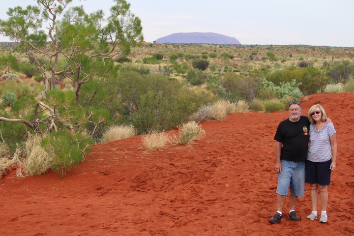
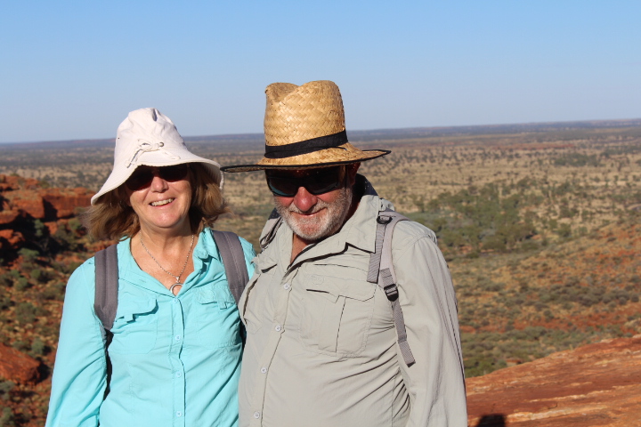
As retirees enjoying travel we continued our road trip and ventured into Central Australia. We found ourselves experiencing a natural beauty sensory over-load. There’s nothing quite like getting up close and personal to the unspoiled wilderness of this ancient land. Our experience in the Australian Red Centre was beyond our expectations.
We hope our experiences, insights and knowledge as retirees travelling the Australian Red Centre inspires you to plan your own outback adventure holiday.
Driving distances in the Red Centre of Australia.
Alice Springs to Yalara (town near Uluru – Kata Tjuta National Park) – 450 kms
Yalara to Kata Tjuta – 45 kms
Yulara to Kings Canyon – 300 kms
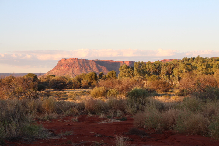
Alice Springs to West MacDonnell Ranges – 100 kms
The above mentioned roads are sealed and in great condition.
Flights are available into Alice Springs & Ayers Rock Airport.
About Uluru – Kata Tjuta National Park
If you haven’t been to the Uluru – Kata Tjuta National Park, put it on your bucket list.
The Uluru – Kata Tjuta National Park is recognised as a World Heritage area. It has dual listings with UNESCO for outstanding natural values and outstanding cultural value. And, we promise you, it is simply an amazing place to visit. You cannot but feel daunted by it’s beauty and it’s aura.
Uluru – Kata Tjuta National Park has a very harsh environment. The weather can often be changeable. The walks are isolated and can be rugged. People need to be aware heat exhaustion and dehydration can be like threatening. Avoid walking in the heat of the day and always carry plenty of water with you. People, particularly seniors, are reminded to follow all safety notices and warning signs.
The park is jointly managed by the Anangu traditional owners and Parks Australia.
Some facts about Uluru (Ayers Rock)
Here are some facts about Uluru:
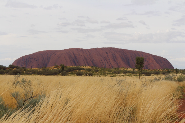
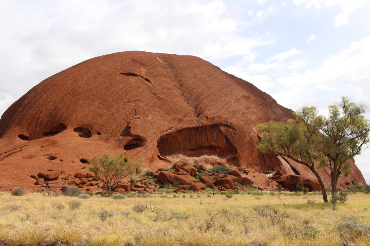
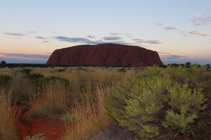
Uluru (also known as Ayers Rock) is a huge monolith rock located in the Northern Territory.
Height – 348m above the plain. It is taller than the Eiffell Tower.
Circumference – 9.4km
Average rainfall – 307 mm per year
Temperature extremes – Up to 47 degrees celsius in summer, and down to – 7 on a winters night.
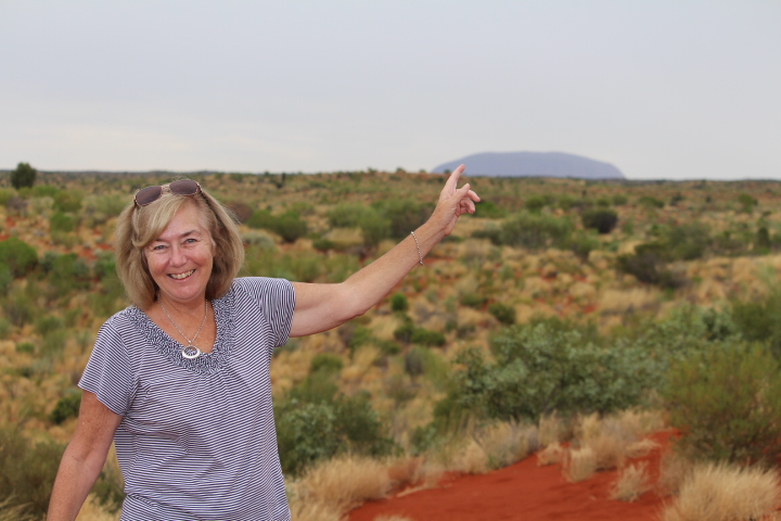
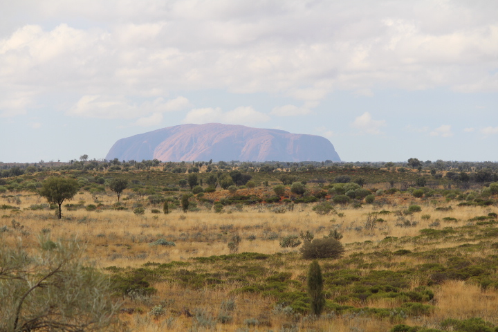
We were about 45 kms out from Uluru when we were able to see it in the distance. That is how huge this rock is!
When we visited Uluru – Kata Tjuta National Park we stayed at the Ayers Rock Resort Campground, in the town of Yalara.
Do you know that Yalara is the fourth biggest town in the Northern Territory? We were stunned to read this fact. We assumed other towns in the Northern Territory would have been larger.
Yalara has a resident population of over 1,000 people. All year round, tourists significantly swell these population numbers.
All your basic needs are well met at Yalara. It has all that a small town has to offer, including a supermarket, Police Station, Medical Centre, Chemist, shops, restaurants, a pub etc.
Tourism is the name of the game at Yalara. There is a range of accommodation options plus tour options
Uluru is made of sedimentary rock called arkose sandstone. Weathering gives Uluru it’s red colour; the same effect as iron rusting.
The colour of Uluru changes all during the day. The colour depends on the:
- time of day / night
- whether there is cloud cover or not,
- if it is raining or not
- the angle of sun shining on Uluru,
- and how close you are to Uluru
The colour of Uluru can be pink, mauve, brown, blood red, and even a orange red. There are no filters on any photos of Uluru in this post.
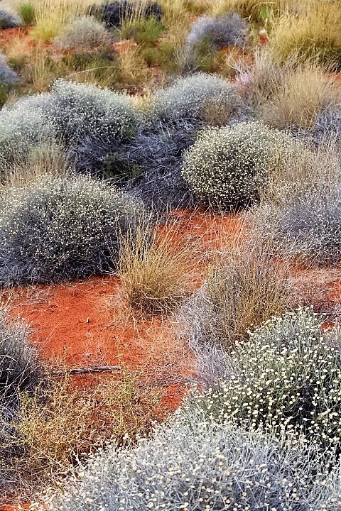
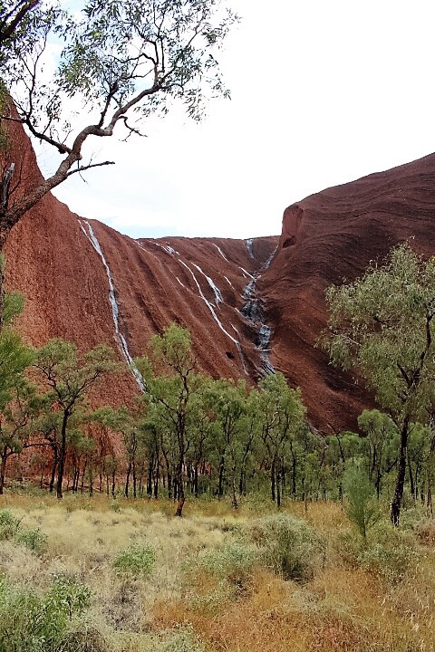
The desert landscape had benefited from rain just before, and during, our visit. Plus the area had received good rain at Christmas time. So, the desert grass and vegetation were plentiful.
On one night during our stay there was a torrential downpour of rain. This is unusual, as it doesn’t rain very often at Uluru. We were so lucky to see the after affects of rain on Uluru. In the photo below you can see low cloud over Uluru and water flowing down the sides.
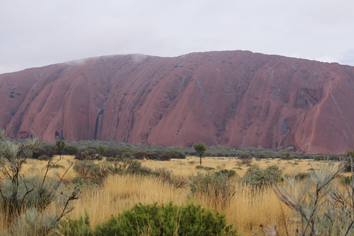
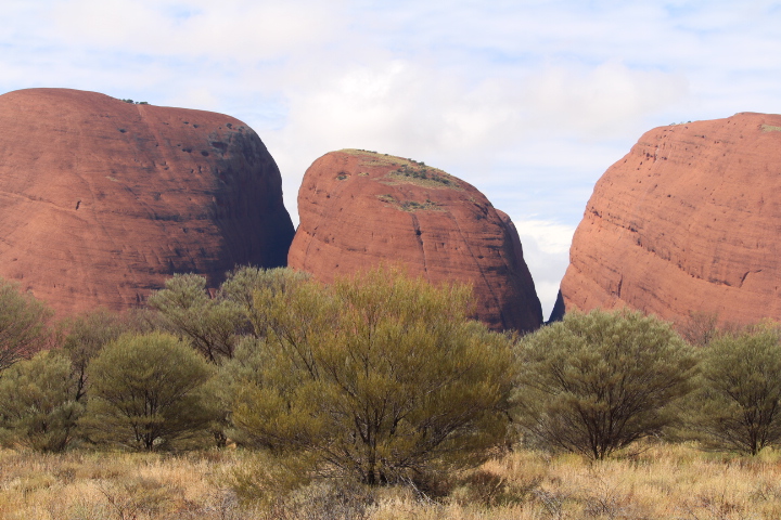
The desert vegetation is simply beautiful, against the backdrop of the brilliant red soil.
Uluru Base Walk
The best way to see and fully appreciate the the natural beauty of Uluru is to walk around it. During the Base Walk you will see signposts explaining some of the cultural significance Uluru has to Aboriginal people.
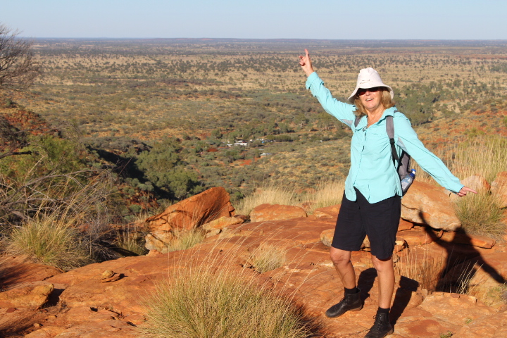
The Uluru Base Walk is 10.6 km, full circuit. It took us 3.5 hours (the average time) to complete the walk. We took our time taking photos, plus stopping to enjoy our picnic.
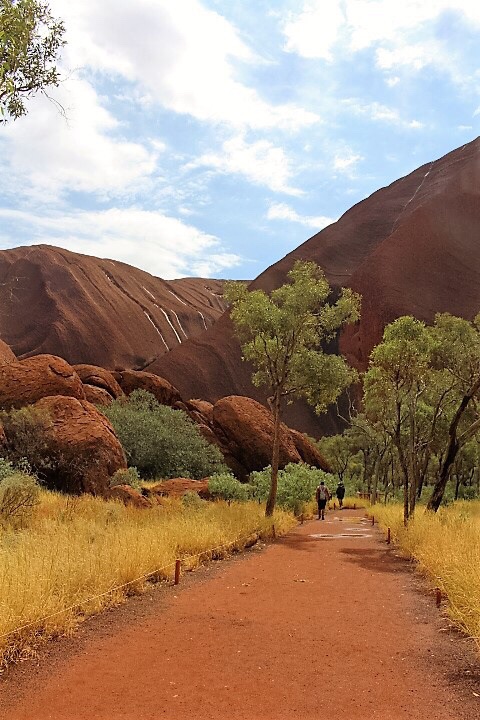
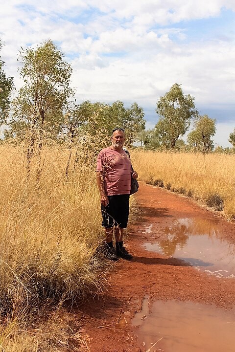
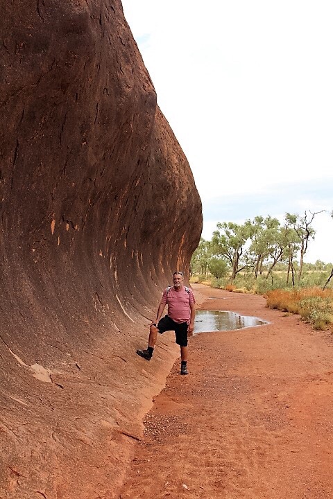
The track around the Uluru Base Walk is flat and easy to walk along. Seniors who are active will easily manage this walk. Our greatest difficulty was negotiating our way around all the large puddles on the track, following the rain the night before.
Wear study walking shoes and dark coloured socks (the red soil stains).
In places the vegetation was extremely high. The area had the best season for decades. Usually there is far less vegetation.
Uluru is the world’s most famous monolith. Yet, it is estimated, 2/3 of the rock is underground.
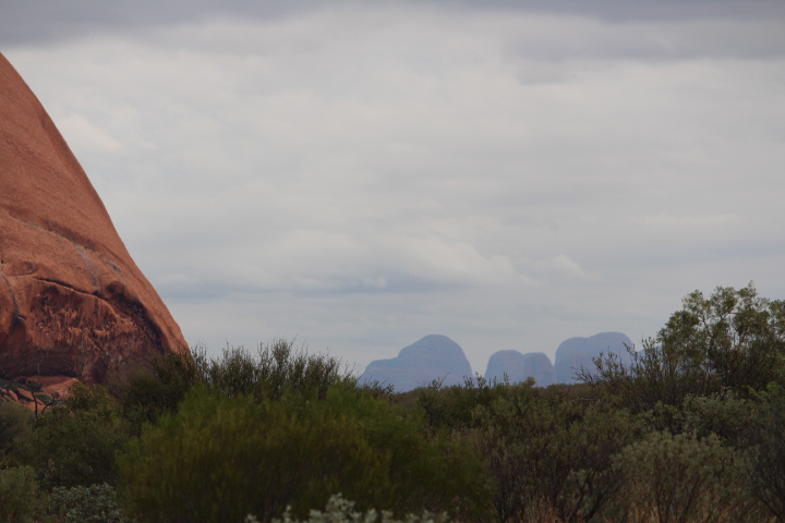
Kata Tjuta is 45 kms from Uluru. We were surprised to see them in the distance as we walked around Uluru.
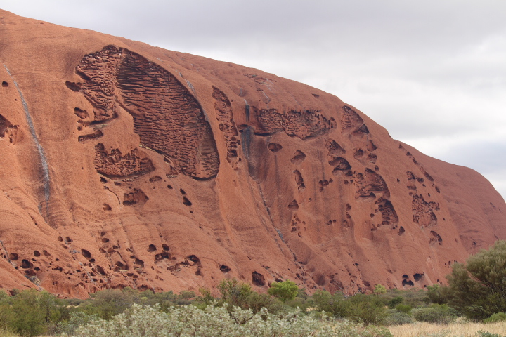
Uluru continually changed it’s shape and appearance as we walked it’s circumference.
Mutitjulu Waterhole At Uluru
The Mutitjulu waterhole is a place of special cultural significance at Uluru.
We were extremely lucky to see water flowing over Uluru. Multiple streams of water flowed into the Mutitjulu Waterhole. It is a very beautiful section of the rock.
The last thing we expected to see at Uluru was a waterhole.
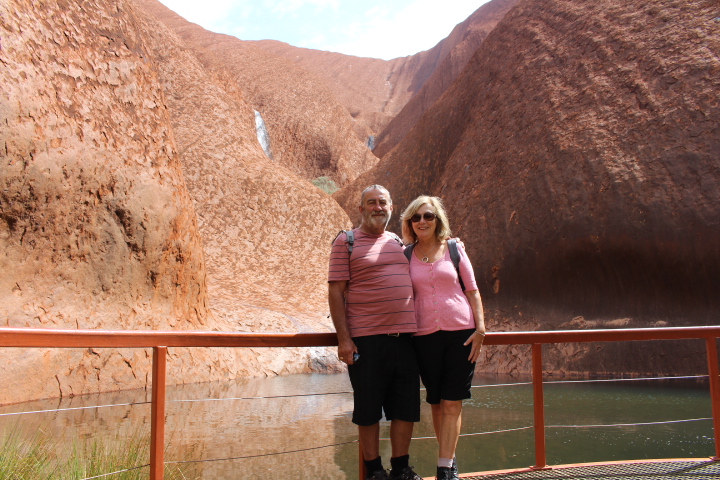
You can drive out to a parking area near the Mutitjulu Waterhole. Then, the walk to the waterhole is relatively short.

Witness an Uluru sunrise.
Witnessing a sunrise at Uluru is a must.
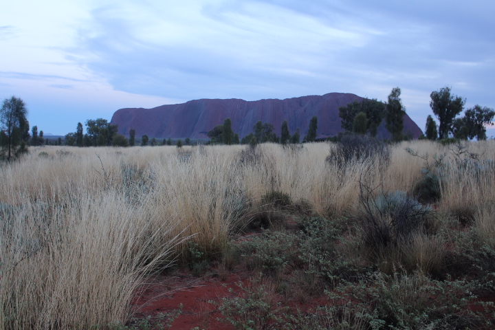
We drove from Yalara, about 20 minutes, to the sunrise viewing platform. It was worth the drive. It is beautiful to arrive in the dark, with the stars twinkling above, and experience the pre-dawn tranquility . The only noise is the chirping of insects, and then the birds. With dawn, the colour of Uluru becomes evident. The colour of Uluru continues to gradually change with the rising of the sun.
There is also a sunrise viewing area especially for buses.
Sunset at Uluru
And a sunset viewing at Uluru is another must.
We were lucky to enjoy two sunset viewings. On the first occasion we drove out to the car sunset viewing area. There were lots of people, all taking photos of the sun setting on Uluru.
When the sun was low in the sky, and shining onto the rock, Uluru became a brilliant red. You can see the shadows creeping towards Uluru in the photo below.
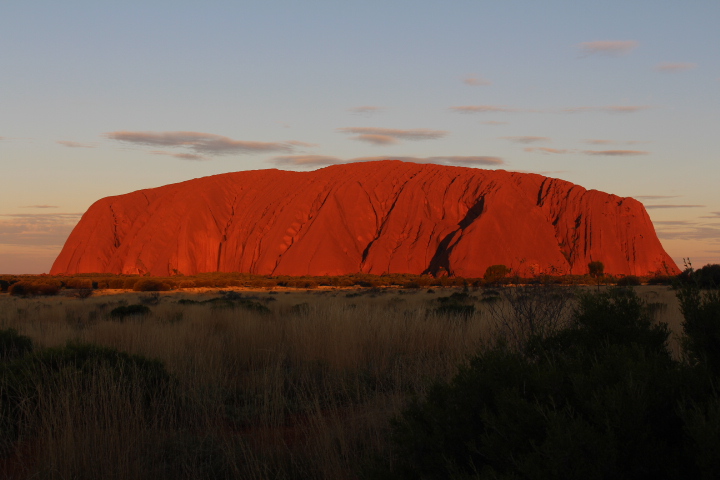
In the twilight Uluru looked magnificent.
There is a separate viewing area for buses
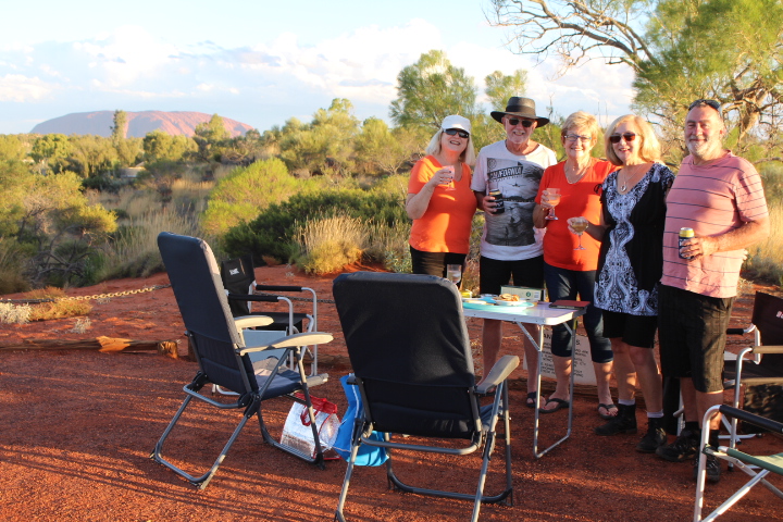
We were lucky to be invited by other baby boomers to enjoy drinks and nibbles, while watching the sunset over Uluru. We enjoyed this sunset viewing from the Yalara campground viewing area. This was great fun. Obviously Uluru is further away, but the view was still great. From this viewing platform you can also view see Kata Tjuta.
And, perhaps you might like to enjoy a helicopter flight over Uluru & / or Kata Tjutu at sunrise, sunset, or any time of day?
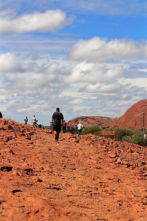
Can you climb up Uluru?
Yes you can. Yet, Uluru is a place of great cultural significance to the Aboriginal people. They request people do not climb Uluru. Even so, some people still do. We were told by a Park Ranger that approximately 25% of tourists currently climb Uluru. When only 20% of the tourists climb Uluru, it is expected the climb will be closed permanently. The Ranger estimated the climb will be closed permanently by 2019 or 2020.
The climb of Uluru is exceptionally steep, and can be dangerous. Over 35 people have died trying to climb it. There are 3 helipads on top of Uluru to assist with rescuing people injured or unable to get down.
The climb on Uluru is closed whenever it is assessed as unsafe to climb. There are multiple reasons why the climb can be closed. Throughout the four days of our visit the climb was closed due to the risk posed by wet weather.
Cultural experiences at Uluru
There are free guest daily activities to enjoy at the Resort.
Below are four we enjoyed.
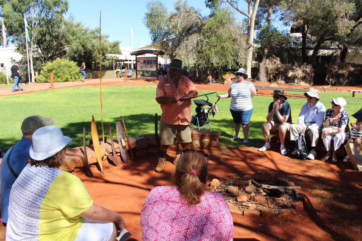
Free Ranger Guided Mala Walk
A Mala Walk is conducted every morning by park rangers. They walk you along a section of the Uluru Base Walk and tell stories of the Mala people; the traditional Anangu culture; and about the joint management of the park. We were also shown aboriginal rock art.
We recommend you put the Mala Walk on your list of things to do.
Culture Centre at Uluru – Kata Tjuta National Park.
In the Culture Centre we saw displays of Aboriginal artwork, plus a video about Anangu culture, ancestral beings, and the significance of Uluru to these people. We also learned about the impact of tourism on Uluru and it’s people over the years, and how the land has been handed back to the traditional owners.
We particularly enjoyed the video, which is presented from an aboriginal point of view.
Wintjiri Arts & Museum
The Wintjiri Arts & Museum is a retail outlet and a gallery. We enjoyed viewing the indigenous art on display. The museum offers insights and history of the local area, and the local Aboriginal culture. Plus there was information about the local geology, flora and fauna. While we didn’t buy anything, we enjoyed wandering through the displays.
Bush Yarns / Circle of Sand at Yalara Town Square
People highly recommended we go and listen to the Bush Yarns, in the town centre. We were so pleased we did. This is another free cultural activity.
We thoroughly enjoyed the presenter and all the stories he had to share. We heard about Aboriginal culture and tradition. Plus the presenter explained how aboriginal tools were made,and then discussed their hunting and food gathering techniques. He was humorous and very informative.
Now I can’t go past a tree without thinking “that branch is a good shape for a boomerang”.
These cultural presentations are run several times per day. Make sure you don’t miss the Bush Yarns.
Field of Lights Tour
We went on the Field of Lights Tour. This is a night installation display comprising 50,000 solar powered lights.
We were taken on a tour bus out into the desert. As you walk around the Field of Lights – it you; 50,000 lights surrounding you; the gentle sounds of the desert, a soft breeze blowing, and all the brilliant stars above. It’s quite a magical experience.
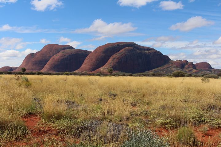
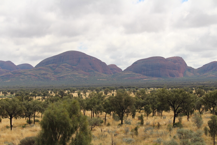
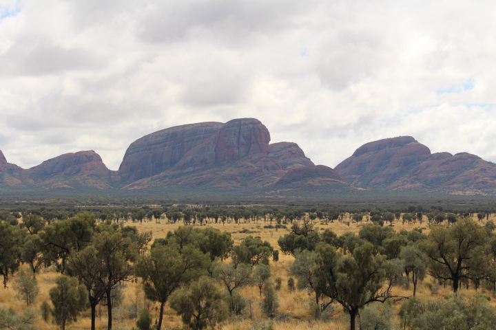
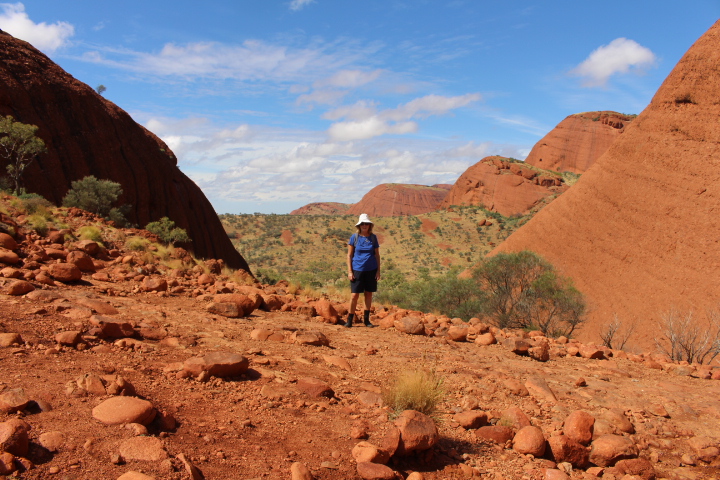
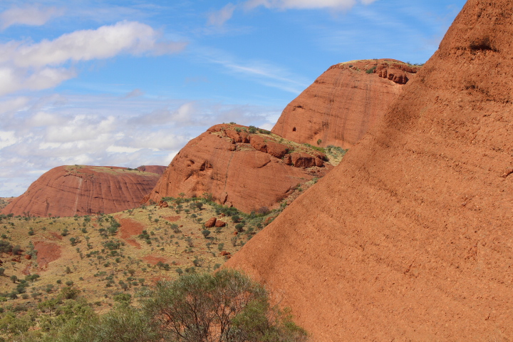
About Kata Tjuta (The Olgas)
Kata – Tjuta consists of 36 domes , the highest being 546m above the plain.
The meaning of Kata – Tjuta is many heads. When you are looking at the rock formations from a distance, some sections of rock certainly look like heads!
Kata – Tjuta is 45 kms from Uluru and Yalara.
When you go out to Kata – Tjuta (The Olgas) stop at the Sunset Viewing Plaform. This is a Grade 1 walk, and is accessible to all. This is a great place to get a general overview of Kata – Tjuta. You can see the all the rocks facing you, away in the distance. We visited this area during the daytime, as we were going on to do the Valley of the Winds Walk.
Valley of the Winds Walk At Kata Tjuta
When at Kata – Tjuta we enjoyed a walk into the Valley of the Winds, to the Karu Lookout.
This is a Grade 3 walk, with a moderate level of difficulty. The walk is only a distance of 2.2 km, yet estimated to take one hour to walk.
Warning – The walk is rocky, with an ongoing incline, and steep in places. We were told a common injury is sprained ankles. As retirees enjoying travel, the last thing we needed was a sprained ankle.
The Karingana Lookout and full circuit walk is Grade 4 – difficult. We did not do this walk. Given the heat, and us as retirees, we decided we had walked enough in the heat.
For safety reasons, the walk can be closed after 11am, if the temperature is above 36 degrees. Dehydration and heat stroke are then major concerns.
Kings Canyon – Watarrka National Park
If you are looking for a wilderness experience in the Northern Territory, put Kings Canyon in the Watarrka National Park on your list.
The natural beauty of the canyon is absolutely stunning. However, this is a very remote area. It is 300 kms from Uluru. Having emphasised how remote the canyon is, we must say the Kings Canyon Resort offers all the comforts you will require during your stay.
We highly recommend the Kings Canyon Rim Walk. And, we believe all the travel and expense was worth the impressive beauty we enjoyed.
Kings Canyon Creek Walk
On the first afternoon we arrived at Kings Canyon we went on the Kings Canyon Creek Walk. This is a 2 km return walk. It is graded as an easy walk, suitable for families.

We enjoyed stunning views of the canyon walls from the path along the creek.
We couldn’t complete the walk due to ongoing repairs following a rock fall.
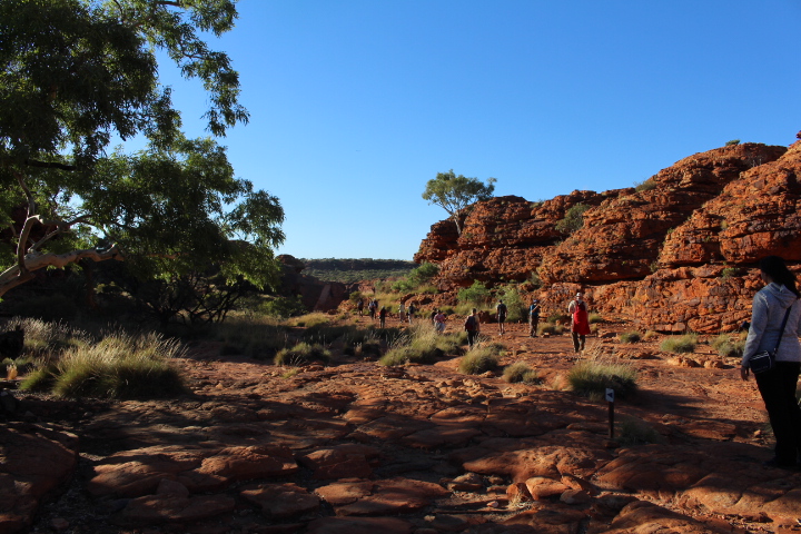
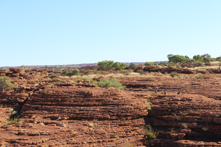
Kings Canyon Rim Walk
This walk is suitable for fit, experienced walkers. It is estimated to take 3 -4 hours to complete the 6km loop around the canyon rim. It took us 3 hour and 15 minutes to complete the walk.
On hot days the walk is closed after 9am. There is no shade when walking the rim.
The canyon is made of two layers of rock – white sandstone and the rich ochre red colour rock. However, to the eye, everything is the ochre red colour.
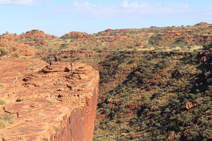
The walk begins with a steep climb up to the canyon rim. The walk is graded moderate, with a hard section at the beginning.
As retirees enjoying travel we do a lot of bush walking. So, we were prepared for the initial steep climb.
The views are spectacular.
There was a continual possession of people doing the rim walk. Many of the walkers were international tourists. And many were baby boomers, just like us.
Along the way we saw wonderful views into the canyon,and areas referred to as the amphitheatre. As you can see in the photo below there were sheer cliff faces and remarkable ochre coloured rock formations.
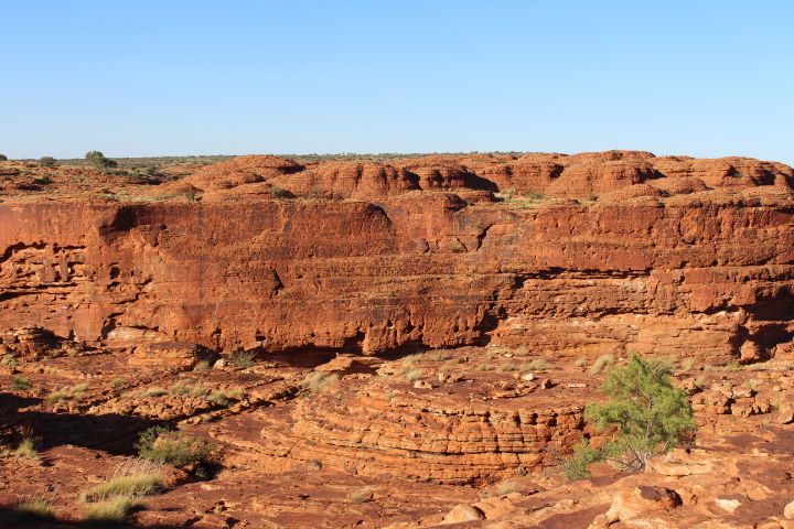
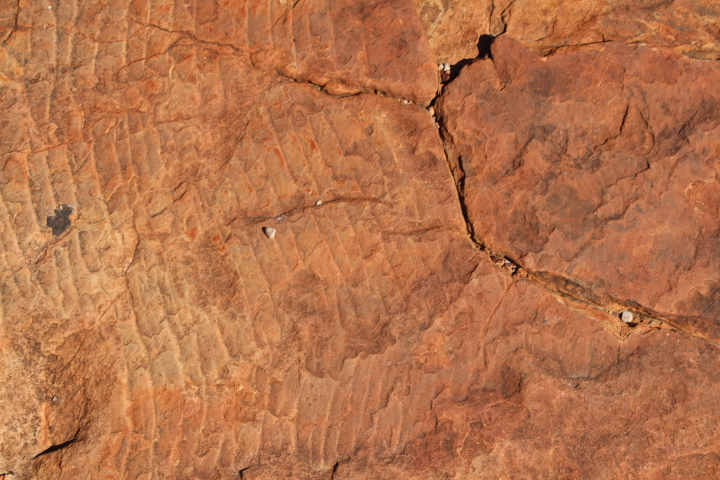
This area is ancient! Wave marks were evident on the rocks. Once upon a time the rock was below a shallow sea.
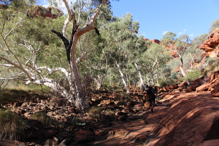
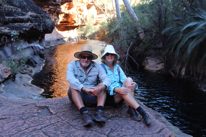
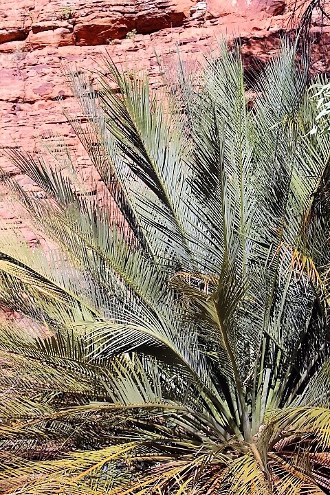
The Garden of Eden at King’s Canyon
After walking along the rim of the canyon we descended into the “Garden of Eden”. We walked down the stairs in the picture below, across a bridge, before climbing down the canyon wall to the waterholes below.
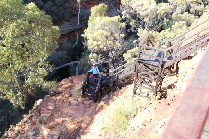
We found lush vegetation and fern shaded rock pools.
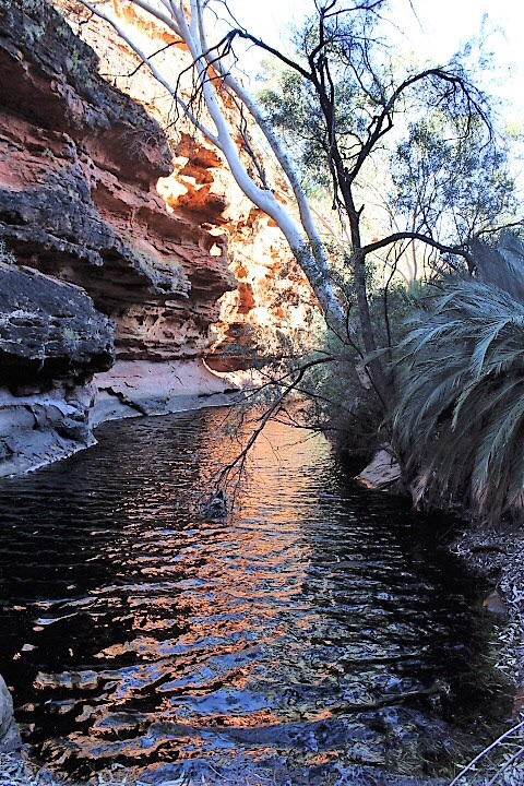
We enjoyed a rest at this stunningly beautiful area.
This is a very important sacred men’s site of the traditional owners.
We read a sign saying the Cycad fern photoed below is 400 years old. Another reminder that this is an ancient area.
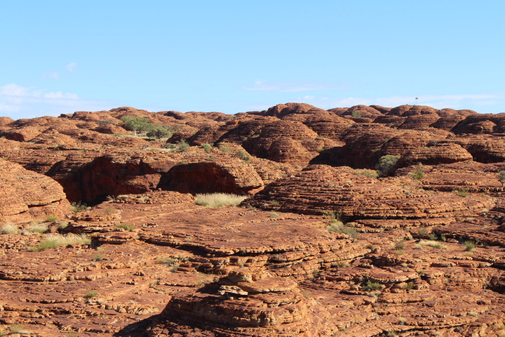
The Domes – “The Lost City”, Kings Canyon
Along the way we saw weathered domes, referred to as the “Lost City”. And that’s exactly what they look like. Don’t you agree?
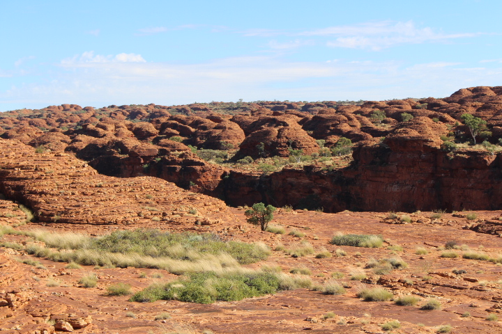
The domes are the result of jointing and weathering. As the tops and sides of the sandstone blocks have eroded, they have formed into beehive like dome shapes.
As we walked along the southern rim of the Kings Canyon Rim Walk we incredible views back over the canyon.
We found a few sections of the southern rim difficult to walk along. While the surface is not overly steep, you need to descend down uneven rock. For us as baby boomers, this was tiring towards the end of this long walk.
Sunset Viewing Platform at Kings Canyon Resort.
There is a sunset viewing platform at the Kings Canyon Resort. We enjoyed watching the sun go down over the escarpment. Many were enjoying a drink as they watched the sunset. The hotel has set up a bar at the viewing area, and BYO drinks is allowed.
In the photo below you can see the shadows beginning to come in, with the last rays of sun shining on the escarpment.
In our opinion, only visit Kings Canyon if you plan to do the Rim Walk. We met other baby boomers who were not fit enough to do the Rim Walk. They didn’t think much of King’s Canyon. We believe the other walks (while pretty) are not worth all the travel and expense. It is a very long way to travel. The diesel at Kings Canyon is expensive – we paid $2.01 per litre in April 2017.
There is the option of a helicopter flight over King’s Canyon.
But, we highly recommend the Kings Canyon Rim Walk. We believe all the travel and expense was totally worth seeing the impressive natural beauty we enjoyed.
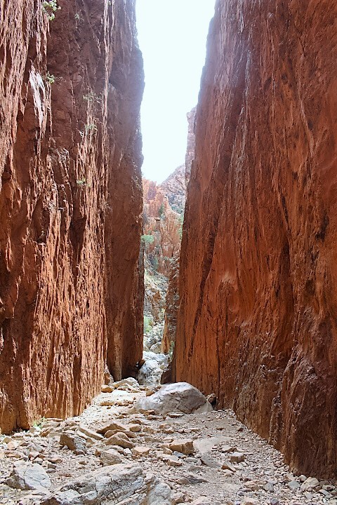
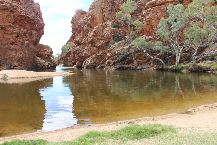
West MacDonnell Ranges -Alice Springs
Don’t forget to include the West MacDonnell Ranges on your Central Australia travel itinerary.
Travel out from Alice Springs to see Simpson’s Gap.
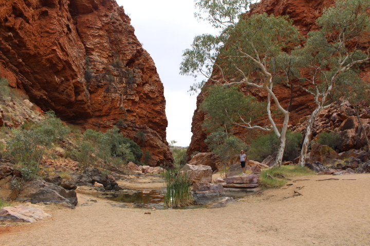
Then, travel on to see Standley’s Chasm.
And, why not enjoy a swim while you are out and about at Ellery Creek Big Waterhole.
For further information about Alice Springs and the West MacDonnell Ranges check out our earlier blog post on Alice Springs: The Gateway to Central Australia
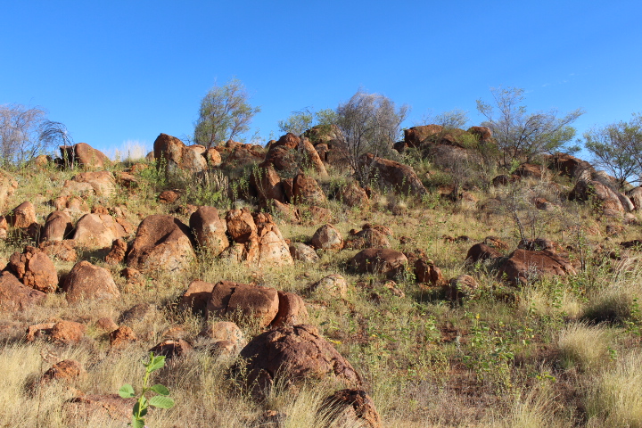
Karlu Karlu (The Devils Marbles)
Karlu Karlu (The Devills Marbles) are located 500 km North of Alice Springs, and 1,000 km South of Darwin.
These are very large, round granite boulders scattered on the desert landscape. Many boulders are sitting on top of others. We wondered how some managed to remain balanced in their strange positions.
The area is protected under Northern Territory law as a Registered Sacred Site.

There is a good overnight campsite at Karlu Karlu (The Devills Marbles). It’s a popular place for grey nomads to stop on the long road trip between Tennant Creek and Alice Springs.

The Campground is about a 1km off the Stuart Highway, 9km north of Wauchope.
Standing among these huge boulders and watching the sunset is a wonderful experience.
Kunjarra / The Pebbles
This is another area with granite boulders, which are known as the smaller relatives of Karlu Karlu / Devils Marbles.
This is an aboriginal sacred dreaming site.
The Pebbles is located 11km north of Tennant Creek. Access is via 6km on an unsealed road, off the Stuart Highway.
We camped at this site. This is another great spot to watch the sunset over the boulders.
Related Links
For further information about travelling the Australian Red Centre please check out the following links:
Guide to Kings Canyon, Northern Territory
And check out Pretraveller’s comprehensive blog post on Central Australia
We hope we have wet your appetite to research and plan an adventure holiday to the Red Centre of Australia. The unique landscape and the rich cultural experiences offer an incredible outback Australian experience. And you can enjoy 5 star comfort if you wish. Do yourself a favour and put Central Australia on your ‘must do’ travel list.
What would you most like to do if you went to the Red Centre of Australia? Or, if you have been, have you any tips?
We would love to hear your comments
Travel safely
Cheers from Estelle and Greg – Retirees Enjoying Travel